Terrain: DTM and Surfaces
In miniCAD, terrain surfaces are created by forming triangles from 3D points and are used to calculate surface areas and volumes. Multiple surfaces may be created and two surfaces may be compared to create a cut and fill volume report.
The natural surface may be used to set the height of new points. (For more information read the miniCAD help section: 'Point Attribute Entry' and read about interpolation.)
To Create a Surface
During surface creation you:
- Select the points to use (via named point selections)
- Specify a boundary string. (to restrict the triangles)
- Delete triangles. (to tidy up convex hulls if a boundary is not used)
- Specify contour intervals and colours. (for plotting and 3D model creation)
- Draw Breaklines. (to define benchs, walls, rivers, ridges etc.)
- Calculate volumes and surface areas.
Note: To view the triangles or contours created you must have them visible in both Terrain>>Settings and View>>Display.
Multiple Surfaces
Create a natural surface and then any number of design surfaces.
You may compare any design surface against the natural surface to produce a cut and fill volume report.
Estimating Excavation Volumes
For example to use miniCAD to estimate the amount of material removed from a construction site...
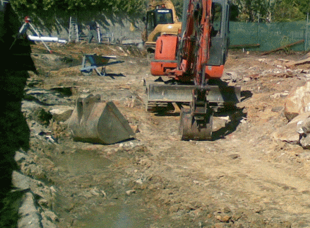
The site, as surveyed, before work commenced...
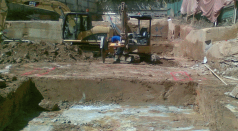
As surveyed, after excavation...
The Cut and Fill Report
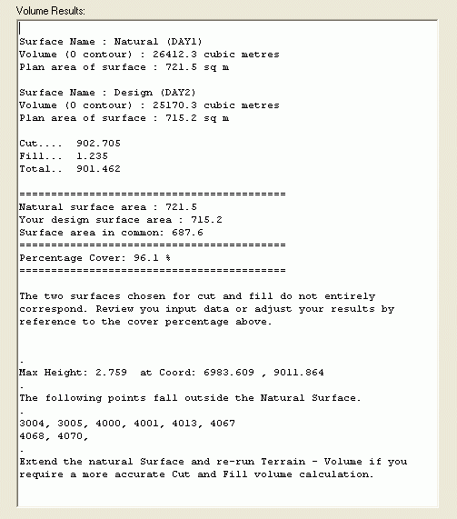
The Cut and Fill report identifies the percentage cover of your design (over natural), the cut and fill volumes and the greatest height. Any points that do not cover the natural surface are also shown.
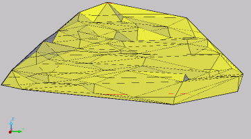
Breaklines
To modify a surface you may add new points and then delete unwanted triangles. Another technique is to add breaklines.
Breaklines are regular lines drawn between contourable points. Use them to define the hinge at the top and bottom of a steep section.
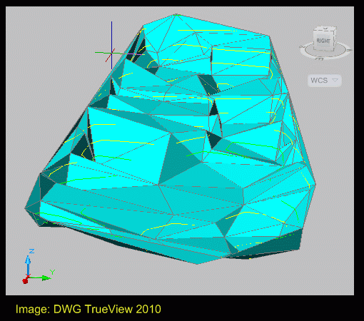
The graphic to the right, was created from survey data after excavation. Without breaklines, the benches and vertical planes visible in the photos are not clear.